


A Structure Detected Beneath Antarctic Ice — Natural or Artificial?
The Frozen Continent That Still Holds Secrets
Antarctica looks silent, endless, and empty from above — a vast sheet of white stretching beyond the horizon. Yet beneath that frozen surface lies one of the least explored landscapes on Earth. For decades, scientists believed the continent was simply ice covering rock. But modern radar, satellite mapping, and deep-ice surveys are revealing something far more complex — mountains, valleys, lakes, ancient landscapes, and unusual formations buried under kilometers of frozen ice.
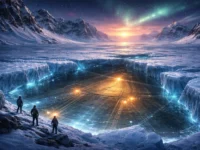
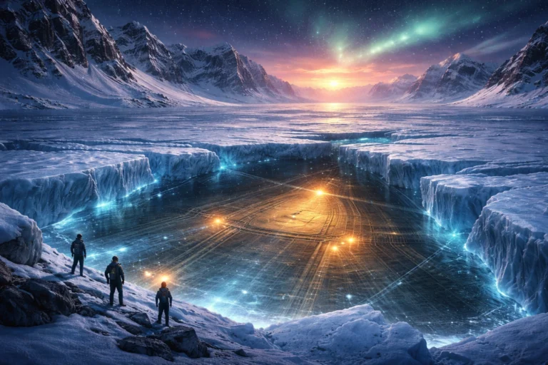
Recently, renewed attention has focused on a strange subsurface feature detected beneath Antarctic ice. Some describe it as a geometric-like structure, while others say it resembles a buried landform shaped by natural forces. The discovery has stirred curiosity across the scientific world and beyond. Is it simply geology, or something unexpected?
This is the real science behind what has been detected beneath Antarctica — and what experts actually believe.
What Scientists Are Really Finding Beneath Antarctica
The Antarctic ice sheet covers nearly 98% of the continent, hiding a vast world underneath. Radar and satellite studies now show that beneath the ice lies a dramatic landscape of mountains, valleys, trenches, lakes, and ridges. Some of these formations are enormous and were completely unknown until recently.
Researchers using satellite imaging and ice-flow analysis have mapped thousands of hidden geological features, including ridges, hills, and deep valleys buried miles below the surface. These structures help shape how glaciers move and how ice melts.
In addition, scientists have discovered hundreds of subglacial lakes hidden under the ice, many of which fill and drain over time, showing that Antarctica is not static but dynamic beneath its frozen shell.
This hidden environment is often called “Earth’s last unknown landscape.”
The Structure That Sparked Curiosity
One of the most talked-about discoveries involves a subsurface formation detected through radar and geophysical data. Some datasets show unusual patterns — shapes that appear structured compared to surrounding terrain. Such findings sometimes ignite speculation because they can look surprisingly organized in radar imagery.
A well-known example is the Wilkes Land anomaly, a massive subsurface feature buried beneath East Antarctica. It has been interpreted by some scientists as a possible ancient impact basin formed by a giant asteroid strike, though it remains unconfirmed because it is hidden under thick ice and cannot be directly sampled.
Other discoveries include buried ancient river systems, vast plains, and geological formations shaped millions of years before Antarctica froze over.
Such findings show that what may appear mysterious at first often has deep geological explanations.
Could It Be Artificial?
The idea that something artificial lies beneath Antarctic ice often appears in public discussions, documentaries, and online speculation. But scientists stress that no verified evidence supports the existence of artificial or human-made structures under Antarctica.
Radar images can sometimes create geometric-looking patterns due to how signals reflect off layered ice, rock, or water. Subsurface mapping often exaggerates symmetry, making natural landforms look more structured than they really are.
In scientific practice, extraordinary claims require extraordinary evidence — and no such evidence has been confirmed.
The Natural Explanations That Scientists Consider
1. Ancient Geological Landscapes
Before Antarctica froze, it was not always a frozen desert. Millions of years ago, the continent had rivers, mountains, and even forests. Radar studies show buried landscapes that predate the ice sheet by tens of millions of years.
These ancient surfaces can appear structured when mapped because erosion carved them into flat plains, ridges, and valleys.
2. Subglacial Lakes and Water Systems
Hundreds of lakes exist beneath Antarctica, some larger than entire cities. These lakes form when geothermal heat melts the base of the ice sheet.
Water flow beneath the ice can carve channels and basins that resemble organized formations when viewed through radar data.
3. Impact Structures
The Wilkes Land feature suggests a possible giant meteor impact beneath the ice, though confirmation remains incomplete.
Impact basins often form circular or geometric patterns, which can appear unusual when seen in geophysical imaging.
4. Hidden Mountain Ranges and Valleys
Satellite mapping has revealed entire mountain systems buried beneath Antarctica.
These massive structures were unknown for decades and only recently mapped in detail.
Why Antarctica Still Holds So Many Mysteries
Antarctica is one of the hardest places on Earth to study. Ice thickness can exceed several kilometers, making drilling and direct observation extremely difficult. Scientists rely on radar, seismic waves, and satellite measurements to “see” beneath the ice.
Because data is indirect, interpretations can evolve as better measurements become available. Many discoveries once considered mysterious later turned out to be natural geological features.
Eyewitness Science: What Radar and Satellites Actually Show
Modern satellite techniques allow scientists to map ice thickness and detect how ice bends over hidden terrain. From these patterns, researchers reconstruct what lies below.
Seismic studies of subglacial lakes also help scientists understand the internal structure beneath ice, revealing water, sediments, and rock formations.
These tools continue to refine our understanding of the hidden Antarctic world.
The Responsible Scientific View
Scientists studying Antarctica emphasize that discoveries beneath the ice are expected, not unusual. The continent hides a vast geological history, and radar mapping continues to reveal new features every year.
While some structures may appear unusual or symmetrical, natural geological processes — erosion, tectonics, impact events, and water movement — explain most formations.
At present, there is no verified scientific evidence supporting the existence of artificial structures beneath Antarctica.
Why This Discovery Still Matters
Even if the structure is natural, the discovery is important for several reasons:
- It improves understanding of Earth’s geological past
- It helps predict ice movement and sea-level rise
- It reveals ancient environments hidden for millions of years
- It expands knowledge of extreme ecosystems beneath ice
Antarctica remains one of the most important scientific frontiers on Earth.
FAQs
Q1: Was an artificial structure found under Antarctica?
No verified evidence supports this claim. Scientists currently interpret such formations as natural geological features.
Q2: What is the Wilkes Land anomaly?
It is a massive subsurface feature that may be an ancient impact basin, though it remains unconfirmed due to lack of direct samples.
Q3: Are there lakes beneath Antarctica?
Yes. Hundreds of subglacial lakes exist under the ice and influence glacier movement.
Q4: Why does radar sometimes show geometric shapes?
Radar reflections from layered ice, rock, and water can create patterns that appear structured even when natural.
Q5: Could Antarctica hide unknown ancient landscapes?
Yes. Radar mapping has revealed ancient river plains and landscapes buried for millions of years.
Disclaimer
This article discusses real scientific discoveries and hypotheses related to subglacial Antarctic structures. No claim is made that artificial or non-natural structures have been confirmed. Interpretations are based on current scientific understanding and may evolve with future research and direct sampling.
Final Thoughts
Beneath Antarctica’s silent ice lies a world still unfolding — mountains untouched for millions of years, lakes sealed in darkness, ancient landscapes frozen in time. Every new radar sweep reveals something unexpected. Some discoveries spark curiosity, others rewrite geology, but all deepen humanity’s understanding of Earth’s most mysterious continent.
Whether the detected structure proves to be an ancient landform, a geological scar, or something entirely new, one truth remains: Antarctica still keeps secrets — and science is only beginning to uncover them.
Reference URLs (Scientific Sources)
- Hidden landscape beneath Antarctica mapped by satellites
https://timesofindia.indiatimes.com/science/satellites-x-ray-antarctica-new-map-reveals-hidden-mountains-canyons-and-72000-hills-under-2-kms-ice/articleshow/127474616.cms - Subglacial lakes discovered beneath Antarctic ice
https://www.livescience.com/planet-earth/antarctica/scientists-discover-85-active-lakes-buried-beneath-antarcticas-ice - Ancient river landscapes buried beneath Antarctic ice
https://www.washingtonpost.com/science/2025/07/27/antarctica-ice-ancient-rivers/ - Wilkes Land anomaly — hypothesized impact structure
https://en.wikipedia.org/wiki/Wilkes_Land_crater - Radar reveals subglacial lakes and hidden terrain
https://www.nationalgeographic.com/environment/article/rivers-glaciers-antarctic-ice-melt-sea-level-rise
0 Comments