

At 05:47 a.m. UTC on January 28, 2025, a commercial Earth-observation satellite completed a routine pass over the western Pacific. The imagery it collected looked ordinary at first glance — open water, scattered cloud cover, the familiar vastness of the ocean.
But analysts noticed something else.
Ships where ships don’t usually cluster. Aircraft movements that didn’t follow typical training patterns. Activity that, while not openly aggressive, didn’t align with routine schedules either.
Within hours, similar observations emerged from separate satellite systems operated by different countries.
Individually, none of it broke protocol.
Together, it formed a pattern.
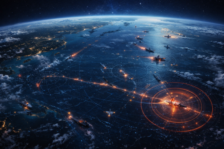
What the Satellites Are Showing
Satellite data doesn’t tell stories. People do. But the data does reveal movement, and movement is where analysts start paying attention.
Since mid-January 2025, open-source satellite imagery and commercial tracking data have shown:
- Increased naval presence across multiple Pacific zones
- Aircraft operating from temporary or less-used airfields
- Support vessels moving ahead of larger fleets
- Repeated activity at similar coordinates over consecutive days
None of this confirms conflict.
But it does suggest preparation.
A former military intelligence analyst reviewing the imagery said during a briefing on February 2, 2025:
“This isn’t chaos. It’s choreography.”
That word — choreography — implies planning without revealing intent.
Why Timing Matters
The Pacific has never been quiet. But military activity usually follows rhythms: exercises announced in advance, deployments tied to rotations, movements explained after the fact.
What’s different now is overlap.
Satellite passes from January 22 through February 4, 2025, show simultaneous activity across regions that are typically staggered. Naval and air movements appear coordinated across distances that span thousands of kilometers.
That level of synchronization is rare outside major exercises — and no large multinational drills were publicly scheduled during that window.
The Official Silence
Governments have not denied the activity.
They also haven’t explained it.
When asked during a press briefing on February 6, 2025, a defense spokesperson described the movements as “routine operations,” without elaboration.
That response wasn’t inaccurate.
It also wasn’t informative.
A retired naval officer familiar with Pacific operations noted privately:
“Routine doesn’t mean insignificant. It means within authority.”
That distinction often gets lost in public discussion.
What This Is — And What It Isn’t
Let’s be precise.
This is not:
- Evidence of an imminent conflict
- Proof of secret warfare
- Confirmation of escalation
But it is:
- A deviation from recent norms
- A shift in posture
- A reminder that readiness can increase quietly
Military strategy often favors subtlety over spectacle.
Preparation doesn’t announce itself.
Reading Between the Orbits
Satellite imagery captures moments, not motives.
But repeated moments tell a story.
Analysts point to several notable features in recent data:
- Ships operating without transponders in international waters
- Aircraft flying extended-range patrol patterns
- Logistics vessels repositioning before main forces
These are supporting moves.
They don’t make headlines. They make operations possible.
A defense policy researcher speaking at a January 2025 security forum explained:
“You don’t surge frontline assets first. You move the invisible pieces.”
That’s what satellites are catching now.
Why This Feels Like Two Realities at Once
For most people, the Pacific looks unchanged — vast, distant, calm.
For analysts watching orbital feeds, it looks busy.
Nothing dramatic. No sudden flashes. No visible conflict.
Just a steady accumulation of signals suggesting readiness rather than reaction.
Same ocean.
Same skies.
Different interpretation depending on where you’re looking from.
The Strategic Context
The Pacific is where logistics, alliances, and deterrence intersect.
Even small shifts can carry weight because distances are enormous and response times matter.
In such an environment, being early matters more than being loud.
Satellite data doesn’t accuse. It observes.
And what it’s observing is a region being quietly organized.
Why This Isn’t Front-Page News — Yet
Because ambiguity is uncomfortable.
There’s no single event to point to. No announcement. No crisis trigger.
Just movement.
And movement only becomes news once it’s explained — or once it’s too late to ignore.
Right now, analysts are watching, comparing passes, and waiting for context to catch up with imagery.
Frequently Asked Questions
Is this unusual activity dangerous?
There is no indication of immediate threat or hostile action.
Why use satellite data?
Satellites provide independent, verifiable observation across vast regions where on-site reporting is impossible.
Could this be a large exercise?
Possibly, though the lack of public scheduling raises questions.
Why hasn’t this been explained?
Military operations often remain undefined until after objectives are met or exercises conclude.
Should civilians be concerned?
At this stage, awareness is appropriate — alarm is not.
What Happens Next
The next phase isn’t dramatic.
It’s observational.
Analysts will track whether activity:
- Stabilizes
- Increases
- Or returns to normal patterns
Each outcome tells a different story.
For now, satellites continue their silent work, circling overhead, collecting pixels that hint at decisions being made far below.
Not loudly.
Not visibly.
Just enough to suggest that the Pacific — vast as it is — is being watched very closely by those who understand how much movement can say without ever speaking at all.
0 Comments